This week I focus on the history of the north half of our island. Datha Island has been inhabited continually from the Late Archaic period (3,000 – 1,000 B.C.) up to the present. I’ll address the prehistoric periods, the Lewis Reeve Sams ownership years, and farming after the Civil War. I am indebted to archaeologist Larry Lepionka and his team for their work back in 1987-1988 to investigate and document the historic sites on Dataw Island. The island would be covered in a forest if left to nature. This is one factor that distinguishes the northern from the southern half of Datha Island. The north half was plowed and cultivated continuously from the mid-1700s to 1960; the southern half was not. The northern half is also where the preponderance of evidence was found for Native American habitation as far back as 3000 B.C. Therefore, where the Native Americans once lived was also the area most disturbed by farming in the 19th and 20th centuries. Kudos go to Lepionka and other archeologists for rediscovering their presence thousands of years before. I’ll explore middens, and then I’ll show you Domino.
The Maps
Before the plantation system arrived on Datha in the mid-18th century, people such as Caleb Westbrook, Charles Odingsell, and the Boone family owned the island. In those early years of British exploration, the island was called Westbrook’s Island. A trading post was here, and eventually, timber was harvested for use in shipbuilding. We also know that Native Americans were on Datha Island for extensive periods from prehistoric times onward.
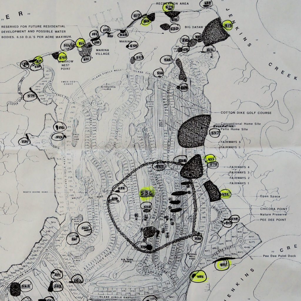
Several cultural resource surveys were funded by Alcoa in the 1980s to investigate the island’s historical context. The historic site identifiers used below (e.g., 38BU494) are assigned by the State whenever such a survey is done. They are permanent so that subsequent surveys can compare locations over time. The identifiers below were assigned when Alcoa contracted for Datha Island’s original cultural surveys in the early 1980s. In the Sources section, you’ll find links to several of these studies. You can use these site identifiers to find out more about the sites.
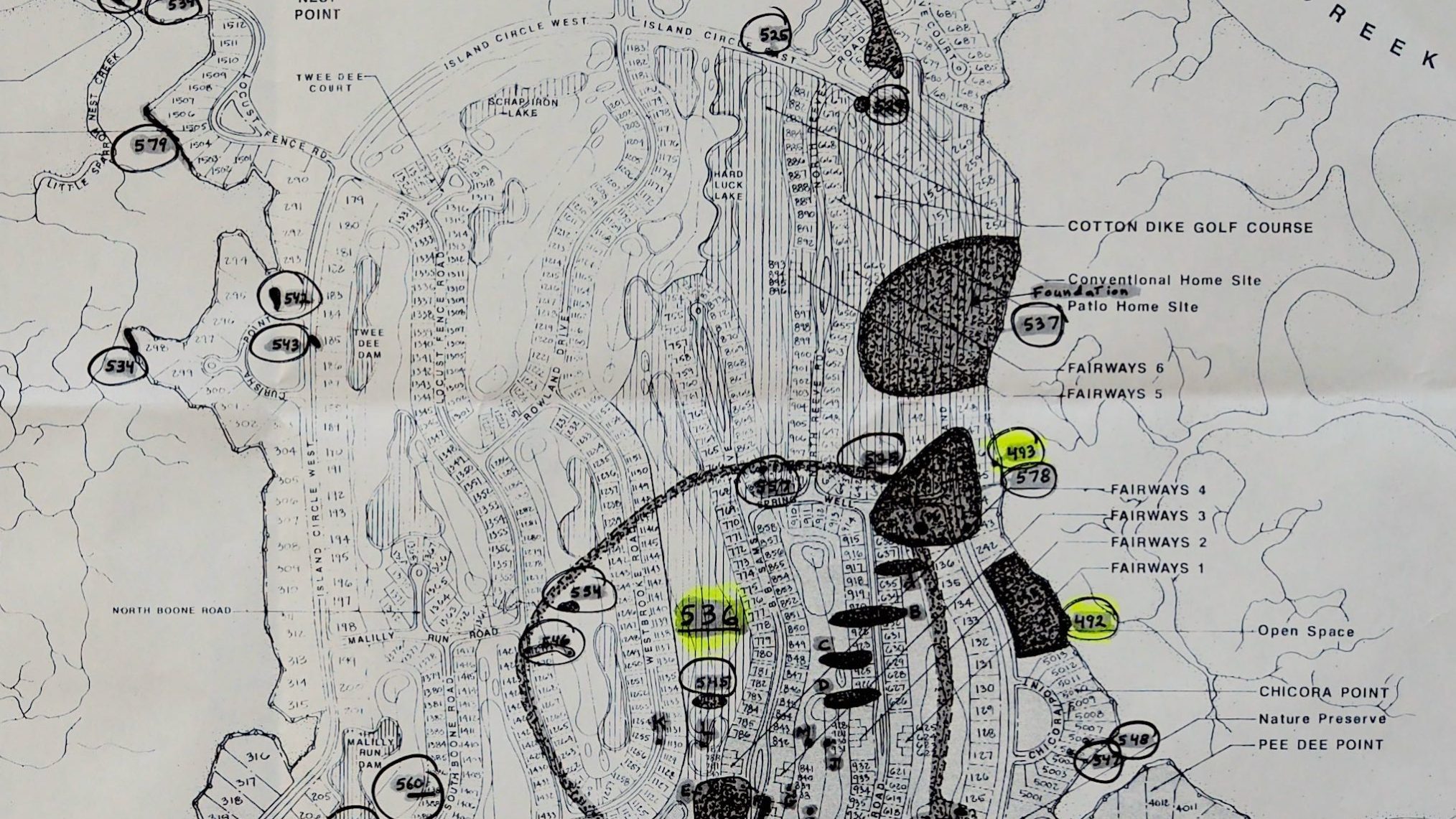
I’ve included two maps below so you can relate to the locations I will be describing. The first map is my modification of a Lepionka diagram from his 1988 report. I’ll only be addressing some of the identified sites in the northern half of Dataw Island in this article. I’ve added to his legend the years associated with the named prehistoric periods. The years for the Plantation and Tenant periods are unique to Dataw.
The second map is an interesting overlay of historic site identifiers on top of a June 1, 1987 map. This map, the Master Land Use Plan for Dataw Island, was created by Alcoa South Carolina, Inc. It is pretty close to what we see today, but not exact. It gives you a sense of which historic sites are near a particular lot. Many of these historic sites no longer exist. They were lost due to plantation plowing, subsequent tenant and lease farming activities, or early Alcoa development and construction. Also, ‘historic’ is in the eye of the beholder. You can argue that some of these sites are more historic than others.
Prehistoric Settlements
The shell middens found on Dataw are directly associated with villages, as a designated village dumpsite. A shell midden or shell mound is an archaeological feature consisting mainly of mollusk shells. They are complex and challenging to excavate fully. Still, they contain a detailed record of what food was eaten or processed and many fragments of stone tools and shards that make them valuable objects of archaeological study. A shard is a piece of glass, pottery, stone, or any ceramic. [Wikipedia]
Starting along Island Circle East (ICE) from east to west as it bisects the island, you come to the turn north at our eastern shore. Here are a few of the historical sites found along the northeastern side of the island, traveling counter-clockwise:
38BU491 & 494: These shell midden sites were near the intersection of Pee Dee Point and ICE. They were identified as resulting from a St. Catherines phase occupation of the Late Woodland period. Native Americans were here in the years 1,000 to 1,200 A.D.
38BU492: This prominent shoreline Late Archaic site is located just north of Chicora Point along our eastern shore and dates from 3,000 to 1,000 B.C. It was the largest, most concentrated, and best-preserved site of this period found on Datha in the 1980s.
38BU536: The site is a complex of 20 shell loci distributed over an area 2,000 feet in diameter and centrally located inland, due east of site 38BU492. Artifacts collected included about 50 fine to moderate cord-marked, plain, and indeterminate shards, all with clay tempering. Test holes dug in 1987 yielded more artifacts from the St. Catherines phase (1,000 to 1,150 A.D.) Today the site is located between Westbrook Dr. and BB Sams Dr., under the MR 17 fairway. It was long ago disturbed by tilling of cotton fields, subsequent forest growth, and later truck farming.
38BU493: This was another shell midden along our eastern shore located near ICE and Spring Well Rd. The midden included clam, conch, and oyster shells. The site was occupied in the 20th century. Lepionka interpreted it as a late 19th to the early 20th-century dump, noting a 1918 map shows tenant structures in the immediate area.
The historic sites below were found along the Morgan river from Big Dataw Point on the east to near Sparrow Nest Point on the West. I’ll cover the plantation sites in the next section.
38BU513: This site had a relatively even distribution of shell scattered over an area of 600 feet by 600 feet site. Digging revealed the site was comprised of a Late Archaic component (3,000 to 1,000 B.C.) stratified beneath a Mississippian occupation (1,200 to 1,600 A.D.) The shell was highly fragmented from intensive and probably deep plowing. Prehistoric artifacts found here included plain ceramics and check stamped ceramics dating to the Deptford era, 500 – 1 B.C.
38BU524, 540, and 519: These sites extended west along the river from the gazebo to the Little Sparrow Nest Creek community deck. 38BU524 was one of the few intact midden areas of the tenant occupation on the north shore of Dataw (i.e., 1861 – 1928). It is presumably related to 38BU541; a large and dispersed shell scatter located immediately south of the midden. The two shards derived from the posthole test are more likely to be Savannah than Deptford.
In the north-westernmost point, with direct access to a marsh channel and the Morgan River, evidence for occupation was abundant – principally at sites 38BU519 and 540.
Site 38BU540 was a multi-component prehistoric and tenant period historic site. The shell distribution pattern suggests that the prehistoric element consisted of a series of discontinuous mounds leveled during the historic period. There were viable prehistoric components inclusive of Late Archaic and Early and Middle Woodland elements.
Site 38BU519: An old roadbed ran east-west at the inland margin of the site. Artifacts found here included shards of whiteware, pearlware sherd, brick, molded dark bottle glass pieces, and miscellaneous iron objects. Two clay tempered fabric impressed shards were recovered in this test, and a heavy cord-marked clay tempered shard was found nearby.
There is nothing left to see of these prehistoric sites except for the artifacts recovered and preserved in the History and Learning Center. We found evidence of visitors long before the Late Archaic period. Still, we cannot determine if they spent any time here or if the artifacts are anomalies that washed up accidentally. However, the extent of shell middens (re)discovered in the early 1980s, primarily along the northeastern shore from sites 38BU492 to 513, imply Native Americans lived in that area of our island for long periods from 3000 B.C. to 1400 A.D.
This link will take you to images in our database of prehistoric artifacts found on Datha.
Lewis Reeve Sams Plantation Years (1805 – 1856)
The plantation system of large agricultural estates arrived in South Carolina in about 1670, then the Province of Carolina. Plantations focused on cultivating one commercial crop, which in our case back then was rice. The other characteristic of a plantation from the beginning was having a distinct separation between owner, manager, and labor. The overseer was the manager, and the enslaved workforce provided labor. Datha, in its earliest days, was not conducive to cultivating rice or any other sustainable commercial crop. But in 1750, indigo arrived in the area and took off.
As you know from my early articles, I believe indigo brought the plantation system to Datha, even before William Sams arrival in 1783. But I only have anecdotal evidence of this. (See Week 8 – Prosperity.)
In the late 18th Century, William Sams, father of Lewis Reeve Sams, wrote in his Will, “my remaining three sons, Lewis Reeve Sams, Berners Barnwell Sams, and Edward Hext Sams … whenever all have arrived at the age of twenty-one than each so arriving of age shall receive part of my remaining fortune equal to the value of what I have given to my son William Sams”. Three years older than Berners Barnwell, Lewis Reeve Sams was independently established with a plantation in 1805.
The Memoir of James Julius Sams, son of Berners Barnwell Sams, states that Lewis Reeve Sams and Berners Barnwell Sams purchased Edward Hext Sams’ interest in the property and that the island was divided into north and south halves. Lewis Reeve Sams was the owner of the north half of Dataw.
In the latter half of the 19th century, the United States Court of Claims Direct Tax Case No. 17379 referred to the Lewis Reeve Sams portion of the island as Datha Point Plantationserver-spaces=”true”>. To continue with the cultural survey report:
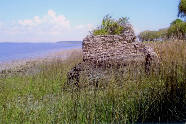
Sites 38BU514 & 515 are the location of the Lewis Reeve Sams plantation complex. The only remnants of the complex at the north end of the island are two small tabby fireplaces on high ground (38BU515) and large elements of a significant tabby structure in the marsh (38BU514). Unfortunately, there is no specific information on this half of Dataw, like that provided by James Julius Sams for the south half of the island. But Lepionka and his team did some extensive research in 1987, drawing these conclusions about the Datha Point Plantation.
Based on the 1850 and 1860 Agricultural Census records, “Cotton was no doubt the major cash crop and the primary source of plantation wealth, but cattle, sheep, and hogs were kept in quantity (with the concomitant production of butter and wool), and significant quantities of maize, sweet potatoes, and peas/beans were raised, much of it certainly for local consumption.
Colin Brooker’s book The Shell Builders was published recently (2020). He has done extensive research on this historic site for Alcoa and the Dataw Historic Foundation – see photo below. He acknowledges that structural evidence of the former Lewis Reeve Sams plantation home is scant. But based on extensive analysis and knowledge of nearly all tabby structures in the Lowcountry and beyond, Colin Brooker has now concluded,
…I believe construction by his father [Williams Sams] or grandfather [ Robert Sams] more plausible.
This north shore location is now the second ruins on Dataw believed to date to the 1700s.
Tenant Period (1866 – 1928)
African American residents remained on the island following the war and into the Tenant period as others leased land for farming. Though a few lived in the southern half of Datha, the vast majority were in the northern part of the island, that section owned by William Irwin (of New York) or his estate from 1864 to 1905.
The earliest legal evidence for the tenant occupation is dated 1875 and consists of a series of agreements between William Irwin and eight individuals. Each person assumed one or more ten-acre lots with the condition of satisfying a crop lien under the requirements of “An Act to Secure Advances for Agricultural Purposes” (passed by the General Assembly 20 September 1866).
The liens’ conditions were not satisfied by the potential purchasers, as their names do not appear again in the chain of title. However, some were long term residents.
The original purchasers in 1875 were W.L. Brown, Nelly Scott, Hampton Mitchell, Stepney Mitchell, Tony Moultrie, Phoebe Bryan, Sam Middleton, and Bosen Johnson (Brown’s land was transferred to Johnson later in the same year). The 1880 Census records reveal a population count for the island of 65 persons. This farm community cultivated 153 acres, of which 81 acres were in cotton, 56 acres in corn, and 17 1/2 acres in sweet potatoes.
In the census of 1900, the population of Dataw was 68. Nellie Scott, Tony Moultrie, Jerry Robinson, Edward Chisholm, and Edward Johnson are on Dataw. The family names Washington and Mitchell also appear on the island. Corn and sweet potatoes were probably primarily subsistence crops, in addition to the river’s traditional foods. Most of these people lived near the north shore.
There were three tenant structures in the northeast corner of the island and two more in the north shore center. One was designated as a schoolhouse; these correspond approximately with 38BU528 and 500/499/582. Finally, there were two houses in the northwest corner, in the vicinity of 540 and 541.
The 15 structures, of which at least 13 are houses, correspond closely in number with the independent farms known to have been present on the island from census data. A cemetery is also indicated on the northwest shore, somewhat south of the known location of 534, but no evidence of it has been found.
This Tenant period ended when Kate Gleason purchased Datha Island in 1928.
Kate Gleason (1928 – 1933)
The tenant occupation period came to an end in 1928 when Kate Gleason purchased the island. Gleason built a house on the northeast shore for her island caretaker. In 1987 what remained was a concrete slab on terra cotta piers. In this period, the southwest sea wall (38BU638) and other sea walls were built or planned. Nathan Robinson, a former island resident, born in 1915, was asked to return to the island to serve as a caretaker. He remained until the property transfer to Elizabeth Sanders Rowland (Larry’s mother) in 1933, on the occasion of Kate Gleason’s untimely death. We’ll never know what Kate might have done with Dataw Island. One possibility is to turn it into a turkey farm!
Her biographer tells us, “Kate’s first thought was to turn it into a huge turkey farm that could employ the local population. To set the project in motion, she planned to bring a friend, Madame Clair Laurels – who was successfully promoting the turkey industry on her [Kate’s] farm near Septmonts, France – and two French families to teach South Carolinians how to raise commercial flocks.” The idea took a turn for the worse, so to speak, when a train carload of turkeys was misrouted to Beaufort, North Carolina, and perished waiting to be rerouted to their intended destination. [Gleason] I wonder what her Plan B was?
Farming till 1960
In the mid-20th century, farming and stock raising were continued by nonresidents. The north shore area remained under cultivation, and the south end was reopened, as shown on a 1956 USGS map of Frogmore. Selective logging also took place from time to time. Lepionka found various sawdust mounds around the island.
The only structures depicted on the island in the 1956 map are the Gleason foundation and a patio cottage built on the east point by the Rowland family near historic site #38BU537. This was a concrete block structure, with the blocks made on site. Cattle were kept on the island during and after midcentury, and the fenced areas and ruins of agricultural structures near the patio cottage date back to at least this period. Otherwise, the fields and pecan orchard along the north shore were maintained into the 1980s. Fields at the south end were allowed to revert to nature when the Bishop family stopped truck farming on Datha about 1960.
The book A Place Called Home has excellent first-person accounts by Sonny Bishop of his family’s truck farming on Datha Island from 1940 to 1960. [Later] They leased the whole island from the Rowland family, raised beef cattle and hogs here, and eventually produced all kinds of produce. The Bishops were one of the first in Beaufort County to stake their tomato crops. The book has great pictures taken in the 1950s of their activities here. The photo below has a particularly good story to go with it.
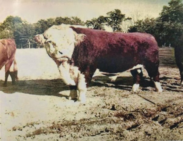
Sonny Bishop tells this story, “We had a prized bull that we named Domino. I told one lady that lives on Dataw now that the picture we have of Domino was taken about where her house is on Island Circle East. I told her if she ever ran out of things to say at a party she could tell her guests,
You know, there used to be a bull just about where our dining room table is.
Alcoa bought Datha Island in January of 1983. To read more about that new era on Datha, see the DHF book Dataw, No Ordinary Place.
Sources
Brooker, Colin – The Shell Builders, 2020, page 160
Gleason, Janis F – The Life and Letters of Kate Gleason, 2010, pages 114-115
Later, Elizabeth Bishop and Bishop, O.R. (Sonny), Jr. – A Place Called Home, 2013, Chapter 5
Lepionka, Larry – Dataw Island, Beaufort, South Carolina – Cultural Resources Survey, submitted to Alcoa South Carolina, Inc., March 1988. PDF
Rowland, Lawrence S., Moore, Alexander, Rogers Jr., George C. – The History of Beaufort County, South Carolina, Volume I, 1514 – 1861, 1996
#52Sams Week 45 – Northern Datha Island
[print_posts post=”” pdf=”yes” print=”yes” word=”yes”]
